Tuesday, September 03, 2013

South Dakota Vacation. The Final day.

We had diverted to Livingston MT but were now ready to continue home.  With the top off of fuel, I knew we could make it to Spokane eliminating any further descents and climbs in the Rocky Mountains.  I filled our new flight plan.

In the plane I called to pick up my clearance.  The controller said that he could give it to me a clearance and release at the same time, so call back when I was ready to take off.  So we taxied out to the east end of the runway, did our run-up, and called for our clearance.  But from there the controller was not responding. After repeated calls I decided to take off and pick up my clearance in the air.  As soon as we were off, I called the controller and he cleared us to climb to 13,000 feet. Yikes, that is a long way up for my little airplane.  It will do it, but regulations say I cannot stay that high more than 30 minutes without supplemental oxygen.

I negotiate with the controller.

IFR Low Altitude chart for western Montana
He says Victor two's Minimum Enroute Altitude (MEA) is 13,000 feet.  True, but not until AFTER the Helena VOR and even then the MEA not only assures terrain clearance but also navigation reception.  I’m in VFR conditions navigating by GPS.  And the satellites above me are not obstructed.  The Minimum Obstacle Clearance Altitude (MOCA) is down at 10,800 feet.  The controller held me at 13,000 until just before Helena, and then cleared me down to 10,000, 800 feet below the MOCA.  Odd, but OK.  Whew.  20 minutes up there and I had a headache.

We were churning along at 10,000 feet and the winds across the Rockies were starting to pick up.  Our little plane was being bounced around.  So I thought I could compromise with the controller at 12,000.  I called requesting 12,000.

On a weak and garbled transmitter a new controller replied.

I read back my clearance "One eight tree (we say 'tree' instead of 'three') five zulu, cleared to climb out of one zero thousand for one two thousand" and began to climb.  At 10,000 feet, I don’t have much climb performance, so about two minutes later as I was just clearing 10,700 feet.

A new voice on the radio came on with some urgency, "Seattle Center, One eight tree five zulu return immediately to one zero thousand feet."

OK, back down to 10,000.

A few minutes later I received "Cleared to one two thousand.  And when you get on the ground, I have a number for you to call."

Uh oh.  That’s not good.  That usually means they want to reprimand you.  I wonder what I did.

Victor two is a straight line between Helena and Missoula.  The MOCA along that route is 10,300 feet, and again I had an odd exchange with the controller.

"Can you accept direct to Missoula?"

Sure, since that is what victor two's path is.

"Cleared direct Missoula at one zero thousand feet."

Now that is just weird. Earlier I was cleared on a 10,800 ft MOCA down to 10,000 and now again on a 10,300 ft MOCA down to 10,000. I'm not worried because it is clear and I can see everything around me. I have no concerns for colliding with the Rockies.  On a side note, the National Transportation Safety Board (NTSB) investigates and categorizes accidents.  They would call colliding with Rockies "CFIT" (pronounced see-fit), or Controlled Flight Into Terrain.


What did concern me was the call I had to make in Spokane.  We landed at Spokane International after our new longest leg of 2:56.  The runways and taxiways are all torn up there for construction, so I got progressive taxi instructions to parking.  We spilled out and I went inside to make the call.  I reviewed all my charts, and played back the earlier diversion and negotiations over MEA and MOCA.

I steeled my nerve and dialed the number.  "This line is recorded."  Well that’s a fine "How do you do."

The same urgent voice that had earlier sent me back to 10,000 feet answered.  "Thanks for calling, I listened to the tape.  You did not get the clearance you thought to climb to 12,000.  But since you read back what you thought your clearance was, we should have stopped you.  You did it right.  Sorry for the trouble, have a nice day."

And with that I let out a big sigh of relief. We exchanged pleasantries and hung up.

It was time for a meal. Again we are loaned a crew car and we head over to Airway Heights to find food.

Departure instructions for Spokane airport
Our final leg brought me back over familiar territory.  The runway at Spokane points directly at the VOR I need to fly over to join victor two.  In fact that is my departure clearance.  Fly runway heading direct to the GEG VOR and join victor two.  And as simple as that, we are on our way to Moses Lake.

My clearance brought me up to 10,000 feet again, well above the terrain.  Along this stretch 10,000 also put us above the thermal turbulence and heat.  Our path took us over Moses Lake, then to Ellensburg.

Crossing the Ellensburg VOR and approaching the eastern slope of the Cascade Range, a thin layer of clouds developed above us. My passengers in the back seat were sleeping soundly.  In the front seats Isaac and I watched as the plane flitted in and out of the base of the clouds.  The clouds sloped down, so as we progressed further into the Cascade Range we got further clouds, and soon we were skittering along the top of the thin fluffy layer.  The tops of the clouds formed cloud-valleys and cloud-tunnels as we raced through them.  It was very pretty.  Isaac and I marveled at the clouds as we bounced from one to the next.


We stayed at 10,000 until well onto the west side of the mountains, still skipping along in and out of the clouds.  We were then cleared turn direct to Paine Field and to descend, first to 8,000, then 6,000, then 4,000.  We broke out of the clouds somewhere below 6,000.  Upon reporting the airport in sight, we were cleared for the visual approach and handed off to the tower controllers.  The plane touched down 2:05 after leaving Spokane.

During the week I had flown over 14 hours on IFR flight plans, logged an hour of actual instrument flight, and made exactly zero instrument approaches.

Monday, September 02, 2013

South Dakota Vacation, the trip home begins. And Stops.

I didn't sleep well that night, knowing on Friday morning we would be starting our journey west towards home and there were isolated thunder storms forecast for the area between Helena and Missoula, and Missoula was my destination for Friday.  I plotted a course reverse of our trip east, and a back-up route to Rock Springs WY, Boise ID, and then back to the Puget Sound.  The southern route would add two hours to the trip.  Friday morning the isolated thunder storms were still forecast, but it looked like there would be a break around the time we would be passing through, so we took off on the northern route. 

I filed out of Rapid City on the same Transition route on which I had flown in, T288.  The flight briefer taking my plan had never heard of a T-route.  He entered anyway, and the flight plan computer accepted it.  He was kind of excited to have learned something. 

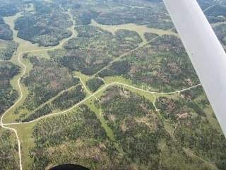
West side of the Black Hills.
Again the flight between Rapid City and Billings brought no surprises.  Take-off, Climb, Cruise, Navigate, Descend, Land – 2:18 of flight.  The highlight to me was seeing Devil’s Tower.  But the heat and turbulence were starting to build, so I could tell my back seat passengers would become miserable soon.  


In Billings we walked to the terminal where we had a very good meal at Gateway Restaurant and Lounge.  I checked with Delta to see if I had enough miles to buy my more delicate passengers a ride home at a higher altitude.  I did, but the next available flight was not until Saturday, and it went through Salt Lake City.  We decided to make a run for Missoula.  The nice folks at Edwards Jet Center provided us a crew car and directions to the CVS pharmacy where we got some Dramamine. 


I filed a flight plan, got one last check of the weather, and decided that the gap between storms was too small.  Not worth taking the chance, so we tied down the plane and headed for the pool.  A lot of work for little progress. 

Again on Saturday we loaded the plane, filed a flight plan, checked the weather, and took off.  


Traveling with a son who has type one, or juvenile, diabetes can present its own challenges.  Hotel breakfasts seem to prefer starches and carbohydrates over protein.  And teenage boys loves them some carbs.  Especially after not eating for the eight hours they were sleeping.  Carbs turn to glucose, and with enough insulin, the glucose turns to energy or stored as fat for later use.  But we miscounted, and the excess glucose over ran the insulin and kicked off and attempt by the kidneys to filter out the excess glucose.

Welcome to Livingston
And that kicked of an unscheduled stop in Livingston Montana.  A wide left downwind 45, and a strong headwind made for an easy high altitude landing.  48 minutes -- this was supposed to be more than a 2 hour leg.  But I would not trade the son for anything.  This is just one of the costs for the privilege of raising him. 

A brief stop, a snack, a little insulin, and all is well.

At 4,659 above sea level, I pondered if it was the highest altitude airport I had landed at.  It is not – Fort Collins at 5,016, Colorado Springs at 6,178, and Rock Springs at 6,765 are all higher.  

Move along there is nothing to see here.

Sunday, September 01, 2013

South Dakota vacation -- a quick hop to Nebraska.

On Thursday, Isaac and I were up early and off to the airport.  There was a thin overcast at 1,200 feet in the area, but it was not reported to be extensive, so we took off for a 40 minute flight to Chadron Nebraska.  We stayed below the overcast until we found a hole in the clouds about 10 miles out.  I made a right turning Chandelle to pop up above the clouds, and then contacted Ellsworth Approach for flight following.  The controllers at Ellsworth advised me that Rapid City tower had been attempting to contact me – but I had missed the call.  I wonder if it had to do with being so low? 


We stayed in contact with Ellsworth approach most of the way to Chadron.  There was no airplane traffic as we were arriving so we made a right base entry into the pattern and landed in state number 25 after 41 minutes of flight. 

Isaac and I parked the plane next to a guy who was hand-propping his old Luscomb airplane.  Hand propping is the airplane equivalent of push starting your car.  If you don’t have an electrical starter, you grab one of the propeller blades the give the engine a spin hoping it starts. 

Chadron, Nebraska
There is very little to see around Chadron.  It appears to be a small farming community.  Still we found plenty of activity at the little airport.  While we were there we met a friendly mechanic with a hangar full of planes he was repairing, and at least three airplanes departed.  Soon Isaac and I were on our way back to Rapid City.  Knowing there was an overcast layer, I picked up flight following from Ellsworth approach in anticipation of needing a popup IFR clearance to land.  But as we drew closer, the overcast had been cleared away.  Just 36 minutes to get back.


25 States down, 25 to go.
I have landed a plane in these states
I am half way.