I brought my youngest daughter
 with me to meet them at the airport a bit before 2:00 pm. I made my usual pre-flight, with Nathan following intently behind, asking about each item on the list. Some questions had easy answers, some not so easy. Things like, "How come there is only a trim-tab on one side of the airplane?" is not so easy. Where as, "Why do you drain out a little bit of gas?" is much easier.
The pre-flight revealed a small amount of water in the gas tank. This can happen when it rains a lot and some seeps in around the cap, or when the moist air inside the tank condenses and the vapor turns to liquid. Either way, the water is heavier than the gas and sinks to the bottom of the tank where a small drain allows it to be removed.
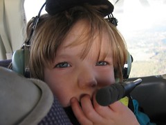
 Randy had flown with me before, so he sent Nathan up front. Randy has this really great desire to honor others in his speech and actions. This desire extends to his son as well. We strapped my daughters car seat behind the pilots seat, and Randy climbed in next to her, and Nathan buckled into the co-pilot seat.
We continued down the check-list for starting the plane until we got to my favorite part of the list -- turning the key. Before starting a plane, there is one last check to make sure everyone is clear of the propeller. I opened the window and shouted "CLEAR!" That for me is the sign that the fun is about to start. Aside from the permission to shout (when else is it considered ok to shout?) it is the official start of powered flight. For me, the process of shouting is that transition.
The sky was covered by broken clouds again today, so after looking about we decided to head southwest. These clouds would later prove to help by keeping us closer to the details of the earth as we made our tour. Once we escaped the surly bonds of earth we headed south towards the hood canal.
 Nathan began to point and ask questions. "Is that Whidbey?" and "Is that Hat Island?" and "Everett?" yep, yep, and yep. For a kid that grew up in Colorado, he knew his way around the Puget Sound.
And then he asked the question that changed the course of the day. "Have you ever flown over Deception Pass?"
We hung a right and headed north up the east coast of Whidbey Island. As we flew north we looked at Port Towsend, Fort Flagler, Fort Worden, and Fort Casey. Casey is the most popular of the three, but my boys and I enjoyed exploring Worden much more. We preceded north by Smith Island and NAS Whidbey up to the pass.
Deception Pass is a narrow opening between the mainland and the north end of Whidbey Island. The island extends south from there 36 miles. For tides to go in and out, the water must either pass through that narrow channel or travel 36 miles around the island. The current can get pretty aggressive.
 Complicating things, in the channel, there is another small island. The road builders used this small island as a pillar for the bridge by building one span from the mainland to the little island, and then a larger second span from the small island to Whidbey. They are graceful arching bridges that contrast with the rugged rocks they are built upon. There are very popular walking paths across the bridge. Flying over the pass in the plane is pretty. Walking across the pass on the bridge is breath-taking.
I often wonder what it would take to get permission to fly UNDER the bridge.
We flew OVER the bridge today.
Our eastward course took us back to the mainland and over to I-5. I gave Randy my camera to let him take pictures. They came out pretty good -- take a look.
After passing the Arlington airport, we crossed over to the east side of the freeway. Shortly after that we were talking to the tower to get our landing clearance, and the ride was over.
Time sharing the world from one of my favorite views with Randy, who searches out Divine beauty, is just one more reason why I fly.
No comments:
Post a Comment