The Request
"Flights Above The Pacific Northwest" or
FATPNW is an active local
facebook group. It has really exploded with activity and flying lore, so much so, that it was recently
highlighted by AOPA on how to connect with local pilots.
In a
recent post, there was a request for someone to help ferry a plane from east coast back to the Seattle area. The post generated a bit of back and forth about the evils of ferrying an airplane for free, and how not charging for a ferry flight hurts the profession and blah, blah, blah. The back and forth kind of set me on edge. The presumption that money was the only moral motivation for ferrying an airplane felt wrong on many levels.
- There was no indication in the request there would be no payment.
- It negated the notion that there could be non-economic motivations, implying adventure or flight time were not forms of compensation.
- It implied that not paying to fly was different than being paid to fly (both clearly lower my cost of flying).
- There were accusations of under-cutting and hurting other ferry pilots (apparently OK to hurt the airplane owners or yourself by paying for flight time)
- It seemed threatening, as though if you were to fly for free you would be black-listed by the professional pilots.
In my opinion the other contributors to the post came off pompous and condescending. Their contributions to the discussion had the opposite effect as was intended and I decided to throw my name in for consideration. My friend, James, had thrown his name in too. The owner of the plane reached out to us and together we decided it would be a fun adventure.
The challenge

After some discussion I was less sure. The two previous attempts to ferry the plane both ending in off airport landings. I only know the details second-hand and cannot find any official reports, but YIKES! The plane had not been flown much in the preceding years but after some inspection and review of the plane’s maintenance records the plane departed the east coast, headed west. About 30 minutes into the flight the engine started to falter, generating less power. The pilot opted to land the plane on a road. The wings were removed, and the plane was transported to a local airport where another examination found no issues with the plane’s systems, and there were whispers in community of pilot error. The plane departed a second time, with a different, more experienced pilot / mechanic. About 30 minutes into the flight, the engine started to falter, generating less power. The pilot opted to put the plane down in a field. The whispers of pilot error were unfounded. This plane has something wrong with it.
The plane was brought to yet another mechanic who tore into it with gusto. The fuel system was examined and tested, the carburetor was removed and rebuilt, the ignition system was disassembled and any suspect parts were replaced. And while it was down, the owner opted to have some other improvements made on the plane. The new mechanic flew the plane repeatedly, accumulating multiple hours of flight time with no issues. It bothered me that no root cause of the failures had been found for certain, but the collection of the mechanic’s flight time demonstrated that something had been made better. So James and I committed to picking the plane up, and getting it as far west as we could, but safety would be our first priority. No night flights, no instrument flights, and at the first sign of trouble, we were putting the plane down at the nearest available airport. The owner agreed.
Day One: TN to OK
James was able to get too Tennessee a day before me and go over the repair paperwork with the mechanic. He was also able to fly the plane over the airport for a couple hours without incident. That evening James flew from Rogersville TN (
KRVN) to Smyrna (
KMQY) just outside Nashville where I arrived later that night.
Early the next morning I requested my first Uber ride and the two of us headed for the Smyrna Airport. While the plane was still in the hangar, we did our preflight to assure the plane was ready.
The winds favored a north departure from runway 01, and the cold morning air had us airborne in a brisk climb out following a left turn to the west. We climbed to 6,500, intercepted I-40, and followed it on a 2.4 hour flight to Memphis. We flew north of downtown, and landed to the south at General Dewitt Spain Airport (
M01), paralleling the Mississippi river. I landed in my first new state of the trip.
We refueled, and calculated our fuel burn at 6.9 gallons per hour (GPH) -- about what I would expect out of a 150 hp engine.
James took off to the south, and made a right turn out over the Mississippi River where we crossed over into Arkansas, my first time in Arkansas, but it would not count until I touched the ground. After an hour and a half of following I-40, James flew north of the Bill and Hillary Clinton Airport in Little Rock Arkansas (
KLIT). James slipped in for a touch-and-go, and we flew around the pattern. He turned the plane’s control over to me, and I touched down for my landing in Arkansas. My second new state of the trip.
We picked up a courtesy car from the airport, went out for lunch, and swung by Walmart to pick up some water and snacks for in the plane. Back at the airport the plane had not been refueled, so our departure was delayed.
Again we calculated fuel consumption at 7.1 GPH -- again, right in the expected range.
I departed Little Rock, climbed to 6,500 feet, followed I-40 North West to Fort Smith, and then West for Oklahoma City. The winds were picking up and our ground speed was reflecting the pain of flying into the wind. Combine that with our delayed departure from Little Rock, and our commitment to only fly in daylight, and we were running out of time. In flight, we re-planned and diverted Okmulgee OK (
KOKM), about 60 minutes short of our planned stop for the night. I landed and took back off, turned the controls over to James and he landed – each of us checking off our final new state for the day.
Okmulgee OK, unsurprisingly, has neither local taxi service nor Uber drivers. But the airport has a courtesy car, and a brief call to the airport manager revealed the location of the hidden key. We had good dinner at a local Mexican diner, and headed to the hotel for a good night of sleep. The strong headwinds were a foreboding indicator of the weather system that was pushing them at us. The forecast was not encouraging, but did offer a small bit of hope. A low scattered layer around 1,000 to 1,800 feet, and high overcast above could allow us to proceed between layers.
Day 2: OK to …
We awoke early and headed for the airport, did a preflight on the airplane, the whole time keeping an eye on the sky to the west. The scattered layer looked manageable. We discussed our limits, if the engine were to give out again we needed some time to set up for landing. There are frequent airports along I-40 so we agreed we could try it safely. We also agreed no lower than 3,000 feet of altitude, and we must be able to keep the ground in sight. James took off, and we headed west climbing between the clouds. But our ground speed was showing a mere 35 knots. The winds were going to make this a long day.
We climbed to 6,500 feet and headed west between the layers. And it just got worse. Soon the scattered layer below us had become a solid sheet of clouds. Our commitment to fly only with the ground in sight required we turned back. Turning with the wind, our ground speed jumped up to over 150 knots; the wind that was slowing us down before, now had us in hyper-drive back to clear air. Just below the edge of the clouds was Jones Memorial, a small airport in Bristow OK. (
3F7). It has a dramatic up-sloping runway to the south, and it creates the illusion you are high on final. James made a good landing, and we pulled the plane in to the lea side of a building to shelter it from the strong south winds.
We hoped to sit it out for a bit while the clouds pushed through. We walked up and down the ramp while we waited. We looked at the other planes at the airport. We looked in the windows of the shop. We looked at the sky. We looked for a restroom. We waited. We looked at the weather on our phones. We looked at forecasts. We looked at the sky. We looked some more for a restroom. We looked at our progress for the morning, 25 nautical miles. A guy in a truck passed by and let us know there was a pilot lounge in the first of two mobile homes. Turns out there was a whole home in the pilot’s lounge. Inside we found shelter from the wind, a restroom, a kitchen, a living area, and a couple of bedrooms.

We hunkered down there for a bit, and then decided to walk 3 miles into town for lunch in continued hopes the sky would return to their earlier scattered condition. We found a Subway sandwich shop, and quaint small town on Route 66, with folks all dressed up after church, and families having lunch together. We walked main street and found a train depot all decorated up for the Christmas train that was taking families for a ride up the tracks a bit, and then coming back.
We walked back to the airport, still hoping for a break in the clouds. It was not to be. We secured the airplane with ropes. We sat in the trailer and read. I finished my book. We debated over who got the bed, and who got the fold-out couch. There was no bedding on the couch, so we brought in our jackets from the plane. James convinced me to take the bed. We headed off to sleep early. But each time I was about to drift off, the trailer was hit by another gust of wind jarring me back awake.
Day 3: OK to NM
My alarm went off while it was still dark; we wanted to be airborne as soon as possible. Outside, the stars were out, the clouds were gone, and there was a light breeze. We also found the gas pump was not working. A warm shower and a granola bar for breakfast, a preflight of the plane, and a new flight plan on file, and we were airborne again for our third day.
Up to 6,500 feet, back over the top of I-40, westbound we went towards Oklahoma City. We chuckled at the way the controllers said “Murican Airlines” and we made the short hop to Sundance Airport North West of Oklahoma City (
KHSD). James again made a smooth landing to the south on the long runway. The FBO at Sundance is a beautiful, modern, glass and marble facility. And they had cheap gas! But now it was Monday morning, and we had hoped to be here Saturday night. We filled up, having only flown 1.5 hours since our last fill up. We wished we had emptier tanks to take the opportunity to buy more of the inexpensive gas.
I took off again to the North and turned west to follow I-40 to Amarillo TX. We churned along at 6,500, but knowing we could soon be in Albuquerque, we needed to know what the little 150 hp plane could do, so I set out on a climb to 10,500 feet. The plane delivered, and we climbed first at 500 feet per minute, and then 400, and then 300 until the altimeter’s hands declared our arrival. We could do it. We motored along in the little airplane as we watched the cars below, and let the plane descend back down to 8,500 at first, and then back to 6,500.
James had not landed in Texas yet, so at Tradewinds Airport in Amarillo (
KTDW), I turned the controls over to him for this landing too. The winds were strong and favoring a short crossing runway. James set up a crab on final, and then rolled in a good right-wing-low cross wind landing. We taxied to the FBO, and set out in search of lunch. We ended up at Whataburger.
 |
| James lands in TX |
We refueled and taxied back out to the short runway for departure. The day before we were amused by a web page listing the
eleven things that frustrate pilots. Number 11 is "taxing to a runway only to find a major wind-shift that requires a runway change." Sure enough, as we got to runway 23, the wind shifted to favor runway 35. Most of the time in a 172 3,000 feet is plenty of runway. But with the crosswinds, the elevation, and the airplane with an unfriendly history, we opted to taxi back, and use the longer runway. When we reached it the winds had shifted again to favor 23. But now we were on a long runway. We can accept the added distance as a benefit.
The Longest Leg

Out of Tradewinds we started our climb to 8,500. Most of our travel so far was over low terrain rarely rising over 1,000 feet above sea level. But coming up on this leg into New Mexico, parts of our flight would put us over terrain that reached up to 7,400 feet, and then in a mountain pass with 9,000 and 10,000 foot peaks on either side. And there were more strong headwinds to contend with. This would end up being our longest leg. We were showing triple digit ground speeds on the first part of the trip, but as we neared Santa Rosa, we climbed to 10,500 and our progress slowed. We decided that the winds at that altitude were too much of an impediment, so we returned to 8,500. But our ground speed did not return. The winds were fighting us at this altitude too. We pressed on towards Albuquerque at a crawl. My 31 year old Honda is faster than this, I thought to myself. Minutes drug by, cars passed us on the freeway below. We climbed back up to 10,500 as we approached Cline’s Corner. Our ground speed slowed more. We inched towards Moriarty (0E0). The airport hung in front of us while more cars passed. The plane droned for progress.
The controller told us about earlier planes in our area experiencing "severe turbulence." Moriarty seemed to never move closer. We climbed higher in hopes of avoiding the reported turbulence. Sandia East (1N1) came into view. Moriarty stayed out of reach. Time marched on, we did not. We climbed to 12,500 feet. We leaned the mixture more. The engine was at the end of what it could deliver at this altitude. Moriarty had finally moved next to us. Sandia East was just ahead. The mountain pass grew, our view of the city improved, but the GPS’s estimated time to Double Eagle II (
KAEG) was still longer than we anticipated. We recalculated fuel burn, and how long we had already been flying. We tightened our seat-belts for the predicted turbulence.
Sandia East finally passed below. The airplane inched forward towards the pass. We anticipated the turbulence. We were finally in the pass. To the right we could see the west face of Sandia Peak. I looked for the tram but could not spot it. The city was in full view, and we had traversed the pass without getting bounced around.
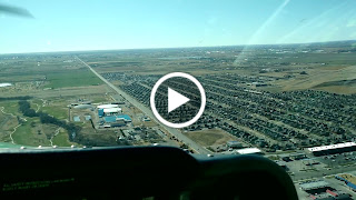
We aimed towards Double Eagle II and started our descent. We were cleared to land, James gave me the controls so he could take some photos. Vectoring the plane on final, we passed between the airport and a couple of hot-air-balloons. This seemed fitting for Albuquerque.
 |
| James lands in NM |
I knew we were at a high altitude airport, so I lined up high and fast to avoid getting behind the power curve and pointed the plane down towards the runway. Due to our extended time flying above 10,000 feet James was concerned about both our judgments being impaired by hypoxia, and he asked me if realized I was high and fast, and still had the power in. I did, but he was also right, it was time to pull the power back and let the plane slow. And down we went towards runway 22. The little 172 lost its airspeed quickly, and soon the flaps were out and we were touching down. My forth state of the trip, and first landing in a couple days.
I powered the plane back up, gave it time build up excess speed, climbed to 500 feet above the ground, turned right to circle back towards the other end of the runway, and turned the controls over to James. James landed on the same runway and we taxied in.
Press on?
 |
| Auto created movie of the adventure |
We had been watching the forecast over North East Arizona for a couple days, and it had stayed pretty consistent. It was forecast indicated clear skies from Albuquerque, over to Gallup, but from there to Winslow, over the Mogollon Rim, and down over Fountain Hills the forecast called for low ceilings and scattered rain and snow. Not worth the risk. We opted to leave the plane at Double Eagle II and take an airliner home for the holidays. Checking off four new states, and a good adventure.
View the full photo album.
 |
| 33 down 17 to go |


No comments:
Post a Comment